
Evaluation SDKs (software development kits) allow you to try out CartoType before you buy a license. You will be able to create a test application and find out whether CartoType is the right solution for you. The evaluation SDKs provide access to all functionality, including interactive map display, route calculation, address searching, and geocoding. API documentation is available on-line.
The CartoType evaluation SDKs (software development kits) are provided for evaluation only, excluding any commercial use. For commercial licensing please contact us.
Platforms
.NET
Sample Maps
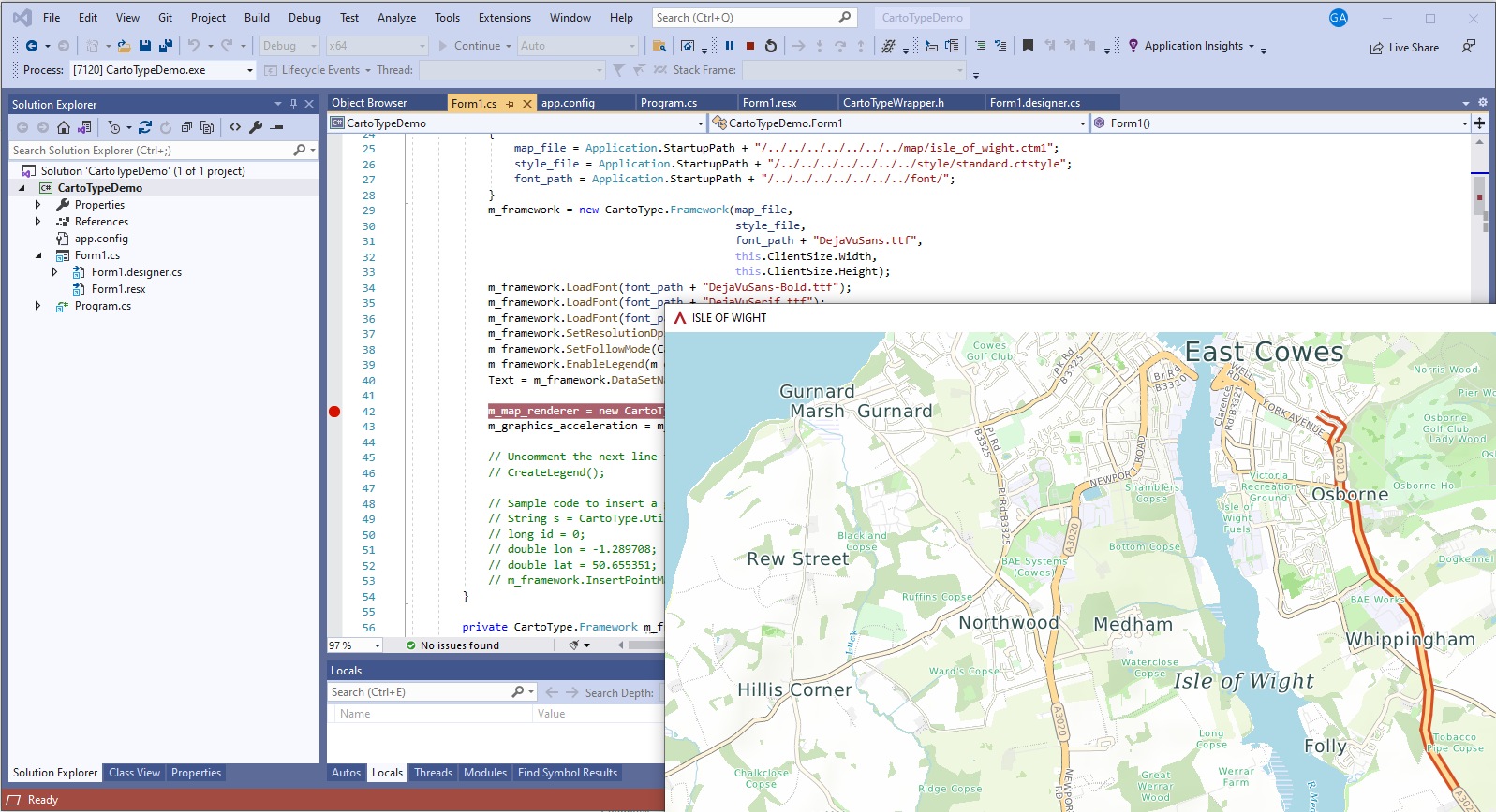
To save download time, the SDKs contain only a single sample map. It is of the Isle of Wight, an island off the southern coast of England, chosen because of its good mix of features: urban, rural, and coastal. Please contact us if you need a map of any particular area for evaluation purposes.
Sample Code
The source code for most of our demonstration programs is available in public GitHub repositories in the account https://github.com/CartoType.The code for the current release is here: https://github.com/CartoType/CartoType-Public. The code is supplied under the permissive MIT license.
Release notes
The current version of the CartoType SDK is release 9.6. It was released on 20th April 2026.
The current build is 9.6-43-g4c75c28f2, uploaded on 1st June 2026.
Changes during the lifetime of this release
Power lines and substations are imported by makemap and displayed using the standard style sheet.
Added PowerPole and PowerTower feature types.
Building polygons and their boundaries are drawn opaque by the standard style sheet.
The Maps App draws correctly in software-rendering mode on devices with non-unity pixel ratios.
The Windows and C# demos suspend unnecessary rendering for non-active windows, giving a smoother user experience.
Added @area and @length special variables for use in style sheet expressions and find conditions.
------ 9.6-29-g4e88e66d9 ------
Fixed @area and @length variables not working in style sheets.
Improved error handling of illegal @-variables.
------ 9.6-34-g66a714588 ------
Fixed #537: map drawn in black in Windows demo after it has been inactive for a while.
Fixed #536: route instructions refer to exit 0 from roundabouts.
The roundabout exit number now stays the same in guidance as the vehicle traverses the roundabout, rather than counting down.
Fixed #539: line breaking doesn't work in Chinese, Japanese and Korean.
Fixed failure of the Linux Maps App to run on Lubuntu.
------ 9.6-43-g4c75c28f2 ------
The Android SDK
The Android SDK allows you to use CartoType with the Android operating system. You use the CartoType Android API, which gives you access to all the features of CartoType: loading maps, adding your own objects to the map, panning, zooming, address searching, routing and navigation.
Download link: Android SDK
The Android SDK is a ZIP file of about 28Mb. It contains a folder called cartotype_android_sdk_evaluation containing the following folders:
libs: an .AAR (Android archive) called cartotype.aar, which is the CartoType library. Add it to your Android Studio project as a dependency.
font: standard fonts; for simple CartoType use you need load only DejaVuSans.ttf
map: sample maps
style: the standard style sheets; you should load standard.ctstyle with the sample map
doc: licenses and acknowledgments for third-party libraries
Android demo program with source code
CartoTypeMaps is a full-featured sample program for CartoType on Android. It's provided as an Android Studio project, and includes the handling of user gestures for panning, zooming and rotation, routing using different profiles, turn by turn navigation, finding placenames and addresses, night mode, and perspective mode. You can set the start or end of a route using a long press. Other features are available from the menus. CartoTypeMaps is ready to run. Just download the code or use git to clone the repository (git clone https://github.com/CartoType/CartoType-Public.git). Then load the project src/demo/android_demo/CartoTypeMaps into Android Studio, connect an Android device or simulator, and select Run 'app' from the Run menu.
You can download a pre-built version of the CartoTypeMaps program containing a map of London. It is supplied as an APK file.
The iOS SDK
The iOS SDK allows you to build CartoType apps for the iPhone and iPad. It is supplied as a .zip file containing a folder with the name of the release (cartotype_ios_sdk_evaluation_<release>), and inside that a folder named ios containing the frameworks you need: CartoType.xcframework, and MetalANGLE.xcframework, which supports OpenGL graphics. You use the CartoType iOS API, writing youre code in Swift or Objective C, which gives you access to all functionality.
Note: in order to avoid linker errors when using the -ObjC flag, you need to have at least one ".cpp" (C++) or ".mm" (Objective C++) source file in your own project, even if it's an empty one. If your project has ".m" (Objective C) and ".h" files only you will get linker errors because Xcode won't know that there is both C++ and Objective C code in the project.
Download link: iOS SDK
The iOS SDK is a 48Mb download containing the header files and compiled libraries for the simulator and device targets as a zip file. A sample map, style sheet, fonts, and tools including makemap, the map building program, are also included. It contains SDKs for both iOS on a device and and iOS on a simulator. The SDKs are in the ios folder and are delivered as .xcframework files, one for CartoType and one for the MetalANGLE graphics library. When you create an app you will need to add both the CartoType and the MetalANGLE frameworks to your app. Then you need to make sure that they are shipped with the app: select your app in Xcode, then select your build under TARGETS, then Build Phases -> Embed Frameworks, then add both CartoType.xcframework and MetalANGLE.xcframework, and tick 'Code Sign On Copy'.
(If you are upgrading to a new version of the CartoType iOS SDK, you may sometimes find that Xcode does not recognize new Objective C headers or classes. You can usually fix this problem by closing your project, opening the organizer from the Xcode Window menu, select your project, then click on 'delete' opposite 'derived data'. Then close Xcode, reopen your project, clean it and rebuild. Thanks to TigerCoding for this tip from StackOverflow.)
iOS demo program with source code
You can also download the source code and project files for a full-featured sample app with fast hardware-accelerated rendering, handling of user gestures for panning, zooming and rotation, routing using different profiles, turn by turn navigation, finding placenames and addresses, night mode, and perspective mode. You can set the start or end of a route using a long press. Other features are available from toolbar buttons.
To build and run the app, open the project in Xcode on a Macintosh and add the CartoType iOS SDK to it. If you are a licensee you can use your licensed CartoType SDK instead of the evaluation version; change the call to the license() function in AppDelegate.swift so that it supplies your license key. You will need to sign the app using your Apple developer certificate.
You can then run it in the simulator or on an iOS device.
The Linux SDK
The Linux C++ SDK (documented here) supports development for Linux (Ubuntu and other x11 versions) on 64-bit Intel platforms using C++.
The Linux SDK supports developments using various GUI frameworks including Qt.
Download link: Linux SDK
The Linux SDK is a 23Mb zip file containing a folder called cartotype-linux-sdk, which contains the following folders:
bin: the release-mode evaluation CartoType library, and the makemap tool for creating maps, and the other tools mapinfo and encrypt_file, and (for Qt builds) the Qt map graphics-accelerated map renderer library libCartoTypeQtMapRenderer.a and other libraries needed for Qt builds.
font: standard fonts; for simple CartoType use you need load only DejaVuSans.ttf
header: the C++ header files; you need to include only header file, cartotype.h, to use CartoType
map: a sample map
style: the standard style sheet; you should load standard.ctstyle with the sample map
Linux SDK notes
- The CartoType Linux library is built for 64-bit Intel platforms.
- You may need to add the option -lpthread to the linker options, otherwise you might get a linker error for pthread_create.
- Set the compiler option +std=c++17, because CartoType uses C++17.
- If you get linker errors mentioning types in the std namespace, the cause is probably that the CartoType Linux Library is compiled using GCC 5.1 or later, and you are using GCC 4.9 or earlier.
The macOS SDK
The macOS C++ SDK (documented here) supports development on macOS. It is available on request.
The .NET SDK for C# and VB.NET
This SDK allows you to use CartoType with the .NET framework. You can use any .NET language, such as C#, VB.NET or C++/CLI. You can build a complete application using CartoType in just a few lines of code, as shown in the C# demo program included with the SDK. The .NET SDK (documented here) gives you access to all CartoType features, including map, style sheet and font loading, route calculation, navigation and address searching. It also gives access to graphics acceleration using OpenGL ES 2.0.
Download link: .NET SDK
The .NET SDK is a 52Mb zipped file containing a .NET DLL built for the Intel x64 platform and a C# demonstration program that uses the CartoType DLL, with its source code and data files. An XML documentation file is also supplied. As long as it is kept in the same place as the DLL it will provide tool-tip help for some of the functions.
Requirements:
- The Visual Studio 2022 redistributables must be installed. They may be on your target system already. If not, you may get a message starting "could not load file or assembly ... CartoTypeWrapper.DLL". If you have installed the redistributables and your app still fails to start, please try the following fix: right-click on CartoTypeWrapper.dll in Windows Explorer and click on 'Properties' in the context menu, then, if you see the text 'This file came from another computer and might be blocked to help protect this computer', click 'Unblock' to the right of that text.
- The DLLs used for graphics acceleration, libEGL.dll and libGLESvs.dll, which are in the same locations as the .NET DLLs in the CartoType .NET SDK (see below). They need to be accessible to any application using the CartoType .NET SDK.
The zip file creates a single directory called CartoTypeDemo when unzipped.
Useful locations
The CartoType .NET DLL
- release version: CartoTypeDemo\bin\x64\Release\net8.0-windows\CartoTypeWrapper.dll
- debug version: CartoTypeDemo\bin\x64\Debug\net8.0-windows\CartoTypeWrapper.dll
Visual Studio solution and project files:
- CartoTypeDemo\CartoTypeDemo.sln
- CartoTypeDemo\CartoTypeDemo.csproj
Data files
- sample map: map\isle_of_wight.ctm1
- standard style sheet: style\standard.ctstyle
- standard font: font\DejaVuSans.ttf
Extra fonts are also to be found in the style and font folders. It's always a good idea to load DroidSansFallback as well as any other fonts, because it provides characters for many non-Latin scripts.
The CartoType .NET DLL will not run on non-Intel platforms because the CartoType library is compiled into native code from C++.
The Windows SDK
This SDK (documented here) supports CartoType development for desktop Windows using C++.
The CartoType Windows SDK supports development using standard Windows, or using the Qt framework. It includes source code for bothe a Windows demo program using MFC and a full-featured Qt application, the Maps App.
Download link: Windows SDK
The Windows SDK is a 135Mb zipped file containing the CartoType header files and debug and release mode libraries for desktop Windows, built using Microsoft Visual Studio 2019 for the x64 platform.
The zip file creates a single directory called CartoType when unzipped.
Useful locations
Libraries and executables
- release version: CartoType\bin\17.0\x64\Release\cartotype.lib
- debug version: CartoType\bin\17.0\x64\Debug\cartotype.lib
- tools to build maps, etc. (makemap, mapinfo, encrypt_file): CartoType\bin\17.0\x64\Release
There are also directories with the same names but with DLL appended: CartoType\bin\17.0\x64\ReleaseDLL, etc. They contain libraries linked to the C++ runtime library as a DLL, not statically. These libraries can be used with Qt. To build for Qt you will also need to link to CartoTypeQtMapRenderer.lib, which is also supplied. Qt is supported for the x64 builds only. See CartoType and Qt for detailed instructions on using Qt to build and run the sample Maps App.
Headers
- CartoType\src\main\base; you need include only one header file, cartotype.h, to use the CartoType C++ API
Visual Studio solution and project files for the demonstration program
- CartoType\src\demo\windows_demo\windows\CartoTypeDemo.sln
Data files
- sample map: CartoType\map\isle_of_wight.ctm1
- standard style sheet: CartoType\style\standard.ctstyle
- standard font: CartoType\font\DejaVuSans.ttf
Another style sheet and extra fonts are also to be found in the style and font folders.
The UWP (Universal Windows Platform) SDK
This SDK (documented here) supports UWP development in C#, VB.NET and other .NET languages. It is available on request.
The watchOS SDK
This SDK (documented here: documentation is currently the same as for iOS) supports development in Swift and Objective C for the Apple Watch. It is available on request.
Conditions of use
By clicking on any of the links on this page, or by using the SDK material or demonstration programs, or source code, however acquired, you accept the terms of the CartoType Evaluation License and you also accept that neither CartoType Ltd, nor any owners, shareholders or officers of CartoType Ltd, or any other contributors to, authors of or maintainers of the CartoType system, are liable for any damage, direct or consequential, caused by downloading, installing or using the SDK, or by any programs built using the SDK, and that the SDK is not warranted fit for any particular use and is for evaluation use only and may not be used for any commercial purpose.
Uninstalling SDKs
To uninstall any of these SDKs, all you need to do is delete the files from your computer.